COMPLETED PROJECTS
2024 Enhancing coastal water body segmentation with Landsat Irish Coastal Segmentation (LICS) dataset.
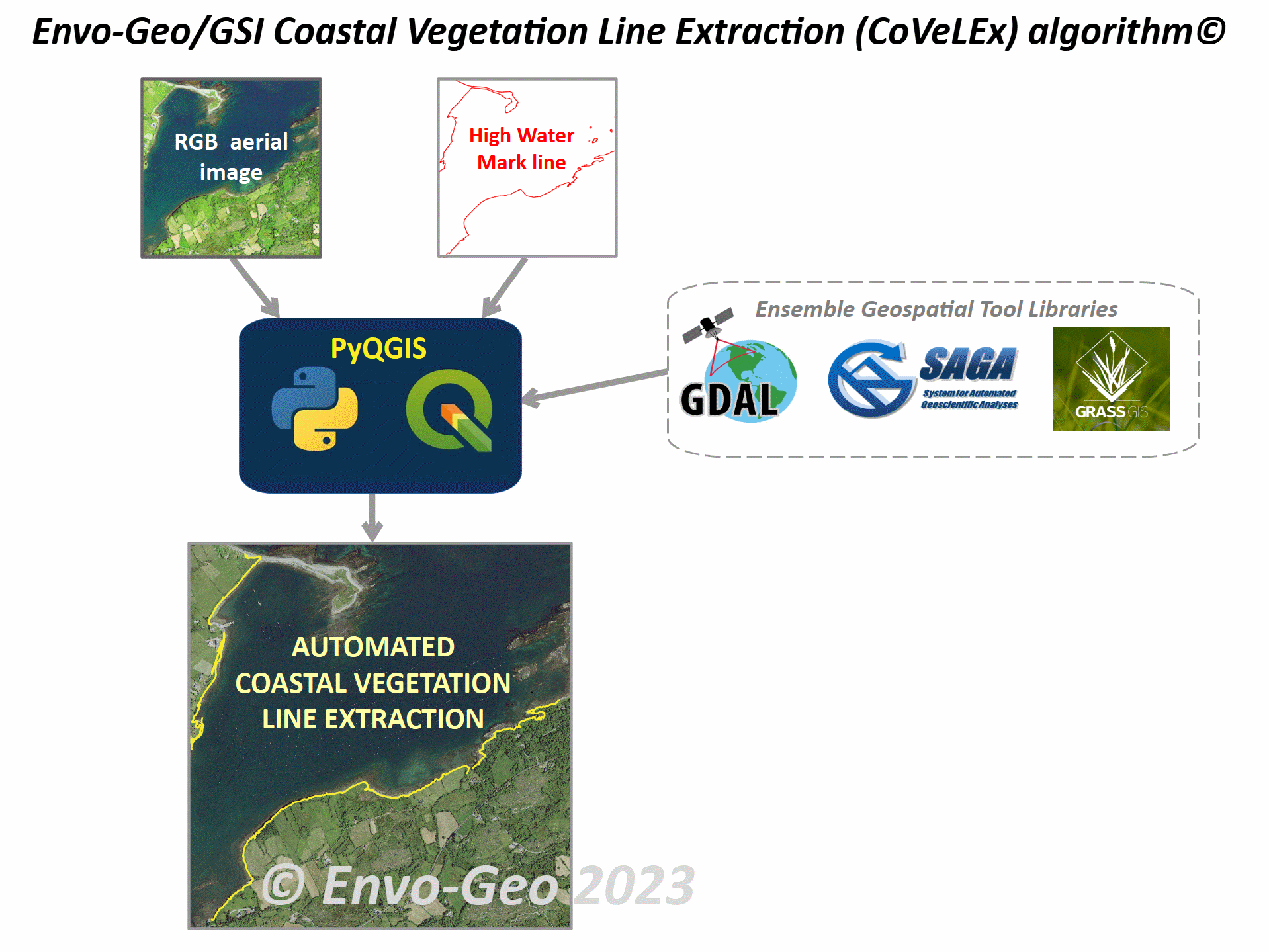
2023 Envo-Geo / Geological Survey Ireland Coastal Vegetation Line Extraction (CoVeLEx) algorithm.
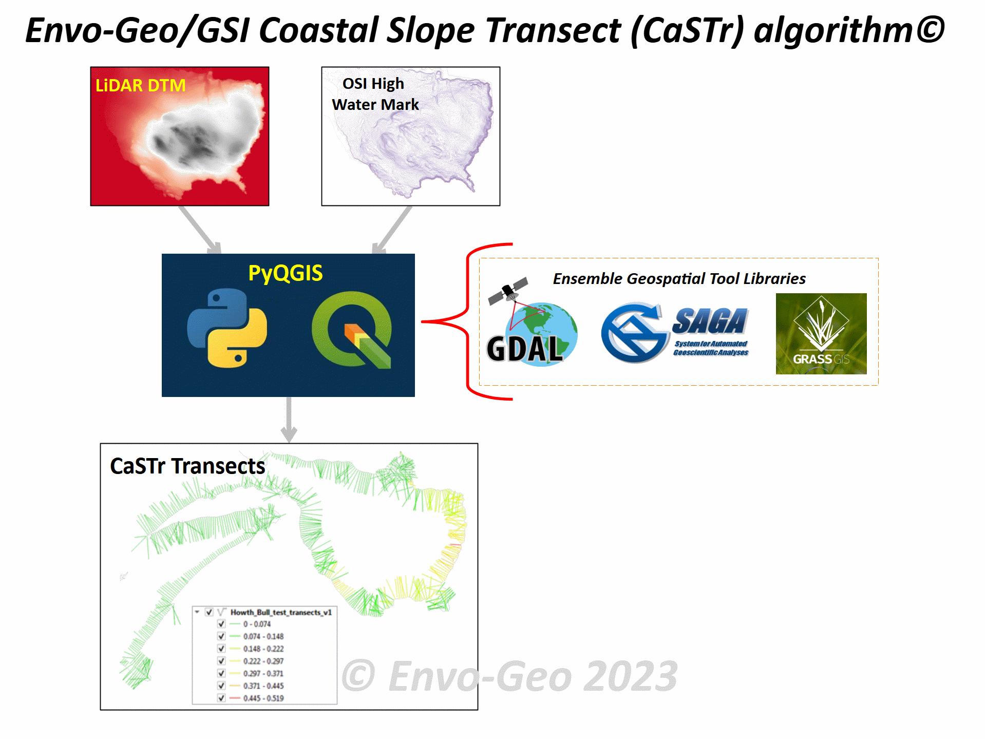
2023 Envo-Geo / Geological Survey Ireland Coastal Slope Transect (CaSTr) algorithm.
2023 Automated Coastline Extraction Using Edge Detection Algorithms.
2022 EO-Intertide: Sentinel-2 Satellite shoreline extraction toolset development on the Irish east coast.
2021 ICESat-2 Marine Bathymetry: Extraction, Refraction Adjustment and Vertical Accuracy as a Function of Depth.
2020 Bathymetric extraction from ICESAT-2 Advanced Topographic Laser Altimeter System photon returns.
2019 EO-Intertide Project: Plan of action. Geoscience Ireland, 2019.
2018 Intertidal Feature Mapping from Sentinel-2 imagery and GSI Drone data (INTREPID) 2017-SC-031.
2017 Lightweight UAV digital elevation models and orthoimagery for environmental applications...
2015 3D Feature Recognition from point cloud and DEM data sets.
2014 3D Classification of morphologically-distinctive Features in the Environment from LiDAR point cloud data.
2013 Land cover dependent error in intermap IFSAR DTM: Lidar comparison and fusion potential.
2013 Association of elevation error with surface type, vegetation class and data origin in airborne LiDAR.
2011 Terrestrial laser scan error in the presence of dense ground vegetation.
2011 The impact of DEM data source on prediction of flooding and erosion risk due to sea-level rise.
2011 Integration potential of INFOMAR airborne LIDAR bathymetry with external onshore LIDAR data sets.
2010 Potential of INFOMAR LiDAR reflectivity in seabed characterisation...
2010 Dual-scale validation of a medium-resolution coastal DEM with terrestrial LiDAR DSM and GPS.
2009 Integration of INFOMAR Bathymetric LiDAR with external onshore LiDAR data sets.
2009 Fusion of Terrestrial Laser scanning, 2D vector and image data in the generation of a 3D campus model.
2008 Laser Scanning for the Environmental Sciences: Issues in Laser Scanning.
2006 Marine Safety Umbrella Operation IT & GIS: Common Protocols & Procedures.
2004 GIS management on planning applications for 400MW of wind energy projects for SWS Ltd.
2003 GIS management on Knockacummer, Gneeves & Owenreagh wind energy projects for SWS Ltd.
2002 GIS management on Kilgarvan, Knockawarriga, Reenascreena and oher wind energy projects for SWS Ltd.
2001 The Potential of LANDSAT TM satellite imagery as a tool for assessing overgrazing damage on blanket bog.